INSIGHTS
What are viewpoints?
Viewpoints are used by architects and planning authorities to improve their understanding of the impact a new building will have on the current landscape or skyline. By using accurate data, our clients can create realistic to-scale mock-up designs of a proposed building in its current urban setting.
Viewpoints are a visual representation of a series of buildings and street furniture within the skyline. The viewpoints show all the bearings, angles, and heights of the different aspects of a structure, enabling architects to create precise images for use in the communication of a development plan. Our team can pinpoint exactly where a building will be placed within an urban setting.
Why would I need them?
When producing images for planning applications, a technically accurate image must be able to stand up to scrutiny in a public enquiry. Viewpoints are generally for buildings and infrastructure that, when built, will be higher than their current surroundings. At Powers, we undertake viewpoint surveys that give our clients the data required to produce the imagery needed, using photography and hi-tech precision equipment. The level of accuracy provided by our team enables clients (such as architects) to clearly communicate their spatially coordinated design concepts to planning teams.
How are viewpoints calculated?
To get true calculations for our viewpoints, we use a Total Station (TS). Our team uses the Ordnance Survey as a baseline, placing the TS in the exact area (which is marked on the ground) our clients have used. As the height of the TS is always 1.6 meters (the same height as the camera used by clients), we use this to calculate the bearings and angles of the skyline.
Viewpoint Examples
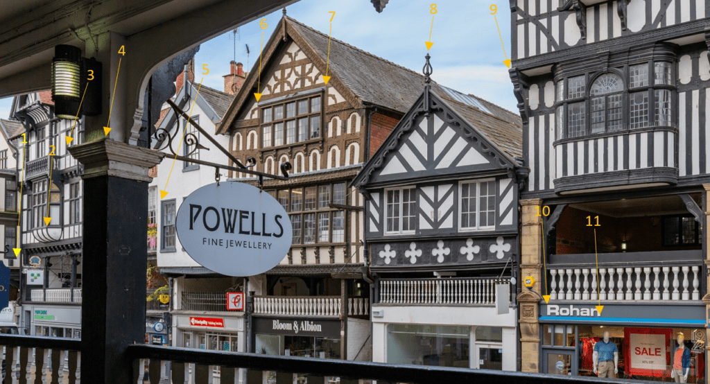
Powers’ image for a client with viewpoints added on
The above image is a visual example of a viewpoint created by Powers for one of our clients. In this image, we’ve used yellow arrows with a sequence of numbers, that point to specific architectural details (window edges, decorative elements, shop signs) on the exterior of a building. In a corresponding document, this classification of numbers is placed in a table with coordinates in relation to the height of the instrument.
With this information, our clients can input this data into their rendering software, such as Revit, and create CGI images of their proposed designs, using the existing dimensions of the buildings, to generate accurate imagery.
This information is provided to our clients in a 3D AutoCAD file, which shows all the coordinated positions of buildings around the proposed urban area.
What are the benefits of viewpoints?
Our clients can design and place a new building into any skyline with viewpoints, they’ll be an accurately measured visual representation of the finished construction. There will be a clear insight into the new building’s placement, as it will indicate a physical presence in the cityscape.
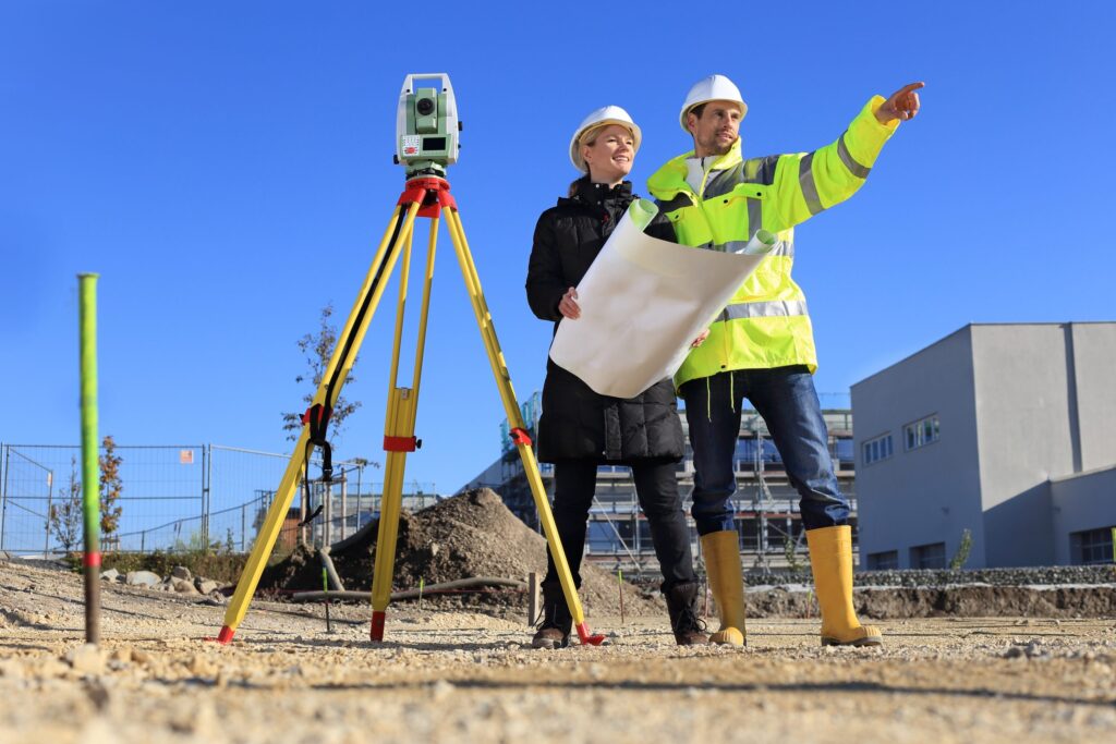
Planning developers on a site
Are viewpoints only for urban areas?
No. Our team have created viewpoints for a variety of other infrastructure types, which you may not think would need viewpoints. Pylons and wind farms are types of infrastructure that viewpoints would be needed for, as their heights are much higher than the surrounding areas.
Do you have a master planning project in your pipeline, that requires accurately measured viewpoints? Contact us for a quote, you can reach us at 01928 734473 or email [email protected]
We look forward to working with you.