Underground Utility Detection Surveys
Subsurface risk, quantified and controlled - PAS 128 data that protects your programme
What is an Underground Utility Detection Survey?
Underground utility detection surveys identify and map buried infrastructure such as electricity cables, gas pipes, fibre networks, water mains and drainage systems before construction begins. These surveys help design teams understand what lies beneath a site so that excavation, piling, foundations and drainage works can be planned safely.
Utility surveys are carried out in accordance with PAS 128:2022, the UK specification that defines best practice for locating underground utilities. By combining records research, site reconnaissance and modern geophysical survey methods such as Ground Penetrating Radar (GPR) and electromagnetic location (EML), we produce accurate utility maps that reduce the risk of service strikes and costly construction delays.
A utility survey should be treated as a live risk-control measure, not just a drawing exercise.
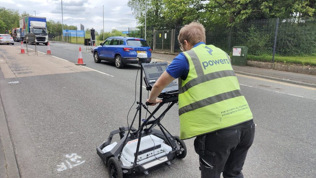
Applications
Used during site planning, design development, pre-construction risk assessments and before excavation works begin. Common across highways, infrastructure, commercial development, utilities upgrades and building refurbishment projects.
Benefits
- Reduces risk of striking buried utilities
- Improves safety planning
- Informs design decisions
- Prevents costly project delays
- Helps contractors plan excavation safely
Deliverables
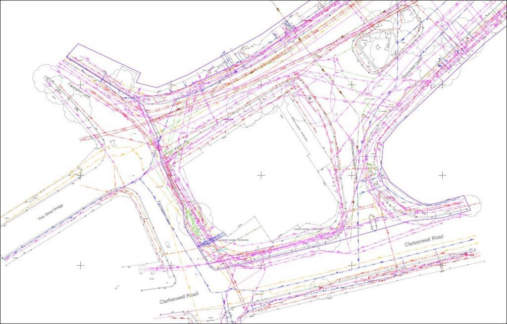
- PAS 128 compliant utility services drawings
- Robust, reliable 2D or 3D sub-surface plans
- Position and depth of non-metallic, fibre optic and plastic buried services
- Utility interpretation reports
- Geo-referenced survey data
- Risk notes for design teams
- Accurate, scaled, colour coordinated presentation of the site as it exist
- Production of a survey report outlining confidence levels
Why do Underground Utility Surveys matter:
- HSE guidance says many serious accidents have occurred when buried services are damaged during excavation.
- HSE also states that contact with underground electricity cables can cause explosion and burns, while escaping gas can lead to serious injury and property damage.
- HSE notes that utility companies alone dig around 4 million holes each year in the UK, excluding construction excavations, so the exposure to buried asset risk is large.
- UK Power Networks has made reducing third-party overhead line and underground cable strikes by at least 20% one of its formal safety commitments.
This is why a utility surveys should be treated as a live risk-control measure, not just a drawing exercise.
Which PAS 128 Level Do I Need?
Choosing the right PAS 128 survey level depends on your project stage, risk profile and type of excavation or construction work planned.
Most projects use a combination of survey types (D, C, B and sometimes A), not just one. Each level adds more certainty to the information you’re designing and building from.
- Verification D – Desktop search
- Verification C – Ground level visual data
- Verification B – GPR / EML detection
- Verification A – Excavation
Why Choose Powers?
We are PAS 128 accredited through The Survey Association’s PUMA scheme. Our surveyors follow recognised industry standards and combine geophysical detection with professional interpretation to produce reliable underground utility data.
Our Services
Topographic Land Surveys
Measured Building Surveys
Underground Utility Detection Surveys
Site Engineering
Boundary Surveys
Geospatial Consulting & Support
Why Underground Utility Detection Surveys from Powers?
Clear, accurate building data is the foundation of confident decisions. Our approach ensures your survey works for your project – not the other way around.
Reduced Risk Across the Project
Accurate utility mapping reduces the chance of striking buried services during excavation – protecting your workforce, your programme and your budget.
Consultancy-First Scoping
We help you define the right level of detection for your project stage and site conditions – so you get the survey you actually need, not a one-size-fits-all approach.
The Right Method for Every Site
We combine Ground Penetrating Radar, electromagnetic location and records research to suit the conditions on your site – selecting the most effective detection method for what lies beneath.
Outputs Everyone Can Use
We deliver PAS 128 compliant CAD drawings, utility interpretation reports and geo-referenced data in formats your design team can work from directly.
50 Years of Proven Practice
UKAS-accredited ISO 9001, ISO 14001 and ISO 45001 systems, backed by UK-wide construction experience and an apprenticeship pipeline that keeps our technical standards moving forward.
Underground Utility Detection Surveys in Action
Our underground utility detection surveys support confident decisions across a wide range of projects. Explore how Powers’ data has helped clients move from uncertainty to clarity.


Supporting Surveys for Complete Site Understanding
Underground utility detection surveys often form part of a wider survey strategy. Depending on your project, you may also need:
50 Years of Trusted Partnerships












Start Your Project With Certainty
Need a quote or some more information?
Call 01928 734 473 or send us a message via the form.
By submitting this form, I consent to receive emails from Powers as defined in the Privacy Policy.