River Channel & Floodplain Surveys
Prove channel capacity and floodplain behaviour before design
What are River Channel and Floodplain Surveys?
A river channel and floodplain survey measures the shape of the watercourse and the land it interacts with. That usually means channel bed levels, bank tops, breaks of slope, structures such as culverts or weirs, floodplain levels, cross-sections and long sections. For flood work, it provides the geometry that hydraulic modellers and engineers need before they can trust their outputs.
This survey is commonly used for developments near rivers, brooks and ordinary watercourses, as well as bridge and culvert design, outfall works, river restoration, flood risk assessments, natural flood management schemes and wider environmental or infrastructure projects. It can also be needed where planners or the Environment Agency require better understanding of how water moves through a site.
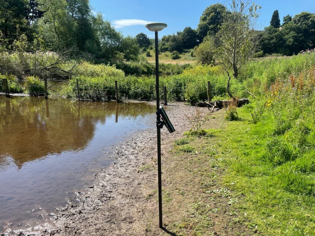
Survey method matters here because access, safety and water depth vary massively from site to site. We select the safest and most suitable approach for the conditions, whether that means GNSS, total station, laser scanning, UAV support or controlled wading for channel data. Just as important, we maintain control and QA throughout so the downstream hydraulic model is not being built on weak geometry.
Applications
- Flood risk assessments and planning support
- Hydraulic modelling inputs for rivers and floodplains
- Bridge, culvert and outfall design
- River restoration and environmental schemes
- Development near main rivers or ordinary watercourses
- Erosion, scour and channel-change investigations
- Wider site topographical surveys in flood-sensitive locations
Benefits
- Provides reliable channel geometry for modelling and design
- Reduces uncertainty in floodplain levels and structure tie-ins
- Supports better flood-risk and mitigation decisions
- Helps modellers avoid costly rework caused by poor survey data
- Improves coordination between survey, civils and environmental teams
- Builds a defensible evidence base for planning and technical review
Deliverables
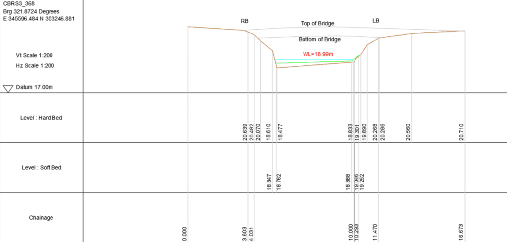
- River cross-sections and long sections
- Channel bed, bank top and floodplain level data
- Structure geometry for culverts, bridges, outfalls or weirs
- CAD / GIS drawing outputs and model input schedules
- Survey control, methodology and QA notes
- Optional wider topographical base plan linked to the watercourse survey
Why Choose Powers?
We are used to difficult sites, we understand the practical risks around watercourses, and we can combine river survey with the wider topographical context so designers and flood specialists get one coherent dataset instead of disconnected pieces of information.
Our Services
Topographic Land Surveys
Measured Building Surveys
Underground Utility Detection Surveys
Site Engineering
Boundary Surveys
Geospatial Consulting & Support
Topographic Surveys in Action
From complex heritage assets to live commercial buildings, our topographic surveys support confident decisions across a wide range of projects. Explore how Powers’ data has helped clients move from uncertainty to clarity.

50 Years of Trusted Partnerships












Start Your Project With Certainty
Need a quote or some more information?
Call 01928 734 473 or send us a message via the form.
By submitting this form, I consent to receive emails from Powers as defined in the Privacy Policy.